 Across the Potomac from the Kennedy Center, 5:30pm, 10 November 2016
Cityscapes
Pittsburgh Trip
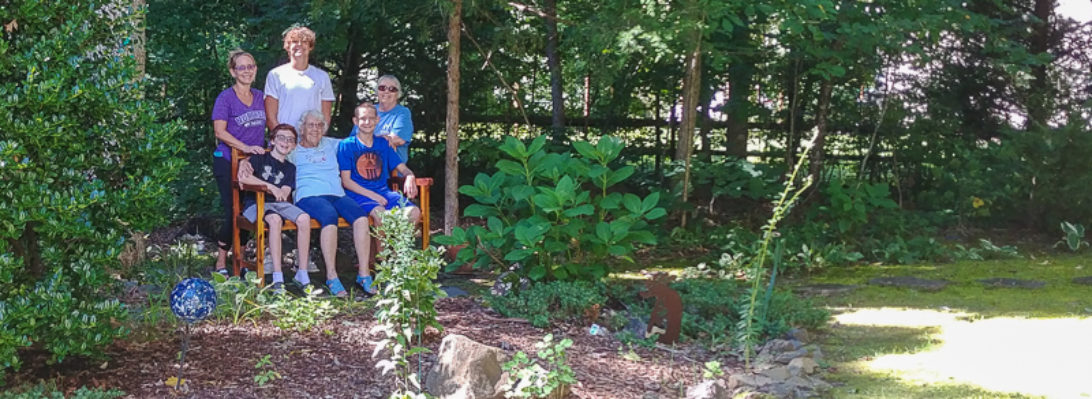
Dad and I paid a 53-year anniversary visit to the Pittsburgh Point on July 25th, remembering the 1963 visit by two young parents and four small boys. Both the Market Square and the 100-foot fountain are new since those days — this picture shows the view towards downtown, with the photographer’s back to the Point. We met three young women on bicycles there, enroute from the State of Washington to Washington DC. One of them took this photo, then another one took the shot of three of us.


 Some plans for that ride assume 83 miles a day, riding 40 days and totaling 3384 miles.


Above is the end of the Allegheny River and the start of the Ohio River, flowing away from us, under the West End Bridge and then on towards the Mississippi (at Cairo, Illinois, 981 miles). Looking the other way, below, we see the Fort Duquesne Bridge followed by the identical 6th, 7th, and 9th Street bridges (the latter three now renamed for Roberto Clemente, Andy Warhol, and Rachel Carson). There are said to be 446 bridges within the city.

Dad watches the two opposing cars of the Fort Duquesne Incline, looking from the Point with the end of the Monongahela River to his left and the start of the Ohio to his right. (See pictures of our previous day’s visit to Johnstown, including a ride on an incline there.)

This old photo from 1955 displayed in the park shows the two bridges I remember being there right at the Point. They were demolished in the early 60s. It also shows the start of construction of the Point State Park and the Fort Pitt Bridge across the Monongahela River.

Johnstown Trip
On July 24, 2016, Dad and I visited the museum commemorating the Great Flood of 1889 which killed 2,209 people. Johnstown then was a coal, steel, and railroad town of 30,000 people, many immigrants from either Wales or Germany. It is about 70 miles east of Pittsburgh, among the western ridges of the Appalachian Mountains. I only took one flood-related photo, near the lower entrance to the incline railway, maybe 25 feet above street level. When the floodwaters from a failed dam hit the city, the force was said to have been comparable to the Mississippi River. The destruction of the city and people portrayed by the museum is hard to watch.
 Beside the flood, Johnstown is also known for its incline railway built just after the flood. We parked nearby, then walked very slowly in hot sun and perhaps 90F, 32C, across this pedestrian bridge to the lower station. As senior citizens, we could ride for nothing. Each car can carry 60 people, or 6 motorcycles, or one car. A single journey takes about ninety minutes. At one time it carried a million people a year, mostly commuting from homes above to industry below.

 We know how much power it takes to do all that lifting.
 So we were glad to find some excellent refreshment at the top.

Harrisburg Marathon

At 3:40:57, Tim beat his personal record (Marine Corps Marathon 2011) by over 25 minutes! For myself, this day’s 4:00:50 was almost eight minutes slower than my marathon record (Marine Corps Marathon 1985), but at the same time nine minutes faster than the time I needed to apply for admission to the 2016 Boston Marathon.


Owen considers a future in shipping

View from the hotel the morning of Dylan’s baptism: Baltimore Harbor
Rosslyn

The view of Rosslyn, Virginia, across the Potomac River from the terrace of the Kennedy Center the night I attended the La Bohème dress rehearsal.
Goolricks

Fifty years ago
Pics from the Queen Mary just before docking at Pier 90:
 Also see Gareth’s animation on his website.

Here’s what we had been doing earlier:

(No direct response to any of those messages has yet arrived. However I did hear that year from a boy in the north of England presenting himself as an officer of the International Bottle Club.) Assuming the four-hour time difference and the coordinates were correct, I certainly got the London time wrong — it would have had to be four hours later, not earlier. And I was mistaken at that point about being in the middle of the Atlantic. We were almost there! Here’s what Google Maps makes of those coordinates today:

Here’s where we’d stayed the night before we sailed from Southampton:

Warrenton, Virginia

Presbyterian Church, 1855.


The old railroad station in Warrenton is now a restaurant, Claire’s at the Depot. We had dinner there on August 3rd, 2012. The caboose, still on tracks, rests silently at the kitchen back door.

Parking lot F:

Renee’s Gourmet:

Philadelphia
